Flood (Hydraulic) Modelling
Flood modelling is the process of simulating and predicting the behaviour and impact of floods using computer models. These models can be used to assess flood risk, evaluate flood management strategies, and support emergency response planning.
Flood modelling typically involves combining data on the topography of the area, land use, rainfall patterns, and hydrological and hydraulic characteristics of the river system to create a numerical representation of the flood process. These models use various algorithms to simulate the behaviour of water as it flows through the river system, over land, and through urban drainage systems.
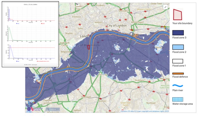
Flood models can be used to predict the extent and depth of flooding, as well as the velocity and direction of water flows. They can also be used to assess the potential impacts of flooding on infrastructure, buildings, and people.
There are different types of flood models, ranging from simple one-dimensional models to more complex three-dimensional models that account for the interactions between water, land, and structures. The choice of model depends on the specific application and available data.
Flood modelling can provide valuable information for decision-making related to flood risk management and emergency response planning. By accurately simulating flood behaviour, these models can help identify high-risk areas, evaluate flood management strategies, and support the development of effective emergency response plans.
